
Processing service · Point clouds and drone data
Raw data in.Clean data out.
Captured it yourself? Send us the raw scan or drone data. We clean it, fix it to your coordinates and deliver it on MapShare, ready to view and download.
- You send
- SLAM scans, drone LiDAR, drone photos
- Files back in
- 3 days from data received
- You get
- Clean, classified cloud on your datum
- Melbourne team
- We sell and support the scanners
- Delivered on MapShare

What we process
Pick one or several. We'll check the data first and tell you what it can deliver.
Point cloud cleaning
People, noise and stray points removed. Tiled and thinned so it opens fast in your software.
In: LAS · LAZ · E57 · raw SLAMRepositioning to control
We move the cloud onto GDA2020 MGA, a site grid or your project control, then check how well it fits.
In: control points · RTK dataPhotogrammetry and orthomosaics
Drone photos turned into a map-accurate orthomosaic, a surface model, a point cloud or a mesh.
In: geotagged photos or a photogrammetry projectMerging and registration
Several scans or flights joined into one cloud, so a whole site reads as one model.
In: overlapping scans or flightsMapShare delivery
Your team opens it in the browser, measures, and downloads the clean files from the same link.
Out: MapShare linkGround classification
Ground points split from buildings, vegetation and everything else, ready for surface models.
Included with LiDAR jobsTerrain models and contours
Contours, spot heights, elevations and sections, with a DEM of the bare ground and a DSM of everything on it.
Out: DXF · SHP · GeoTIFFVolumes and water flow
Stockpile volumes, cut and fill between surveys, and where water will run off and pool across the site.
Out: PDF report · SHP · DXFWhat you can send
Send a Drive, Dropbox or OneDrive link with the data and any control. If you're not sure what you have, send it anyway and we'll look.
| Data | Formats | Notes |
|---|---|---|
| SLAM scans | Raw project · LAS · E57 | SHARE, XGRIDS and other major brands |
| Drone LiDAR | Raw flight data · LAS | DJI Zenmuse LiDAR or other systems |
| Photogrammetry | Geotagged JPG · project files | Orthomosaics, surface models, clouds and meshes |
| Existing clouds | LAS · LAZ · E57 · PLY | From any scanner |
| Control | CSV · TXT | Point IDs, coordinates and the datum they're in |
What you get back
Delivered on MapShare
- A MapShare link your whole team can open in the browser
- The clean cloud and every output ready to download from that link
- A note on how the data was processed and how it fits your control
- Two rounds of revisions if something needs changing
- Files stay up for 1 month, then they're deleted
Files and formats
| Output | Format | Opens in |
|---|---|---|
| Shareable view | MapShare link | Any browser, no softwareClean files download from the link |
| Clean point cloud | LAS · LAZ · E57 | CloudCompare, QGIS, Revit via ReCap, AutoCAD |
| Orthomosaic | GeoTIFF | QGIS, ArcGIS, Civil 3D, Google Earth |
| Terrain and surface models | DEM · DSM GeoTIFF | QGIS, ArcGIS, Civil 3D |
| Mesh model | OBJ | 3D viewers, Blender, SketchUp |
| Contours, elevations and sections | DXF · SHP · PDF | AutoCAD, Civil 3D, QGIS |
| Volumes and water flow | PDF report · SHP · DXF | Any PDF reader, QGIS, Civil 3D |
Works withCloudCompare · QGIS · ArcGIS · Revit (via ReCap) · AutoCAD · Civil 3D · Blender · SketchUp
How a job runs
- 01
Send
Fill in the form with a link to the data and any control. Tell us the outputs and coordinate system you need.
- 02
Check and quote
We open the data, check it can deliver what you need, and send a fixed price before we start.
- 03
Process
We clean, merge and reposition the data, then cut the outputs.
- 04
Deliver
You get a MapShare link with every file ready to download, plus the processing note.
Turnaround 3 days from data received to delivery Quotes within 1 business day
On your coordinates
A scan in its own local frame can't sit beside your design or last month's survey. Repositioning ties the cloud to the control points or RTK data you send, so it lines up with everything else on the project.
We check the result against the control and tell you how well it fits. If the data can't reach the tolerance you need, we'll say so before we start.
How tight the fit can be depends on the data you send. We give you the figure we expect when we quote, and report the real fit with the delivery.
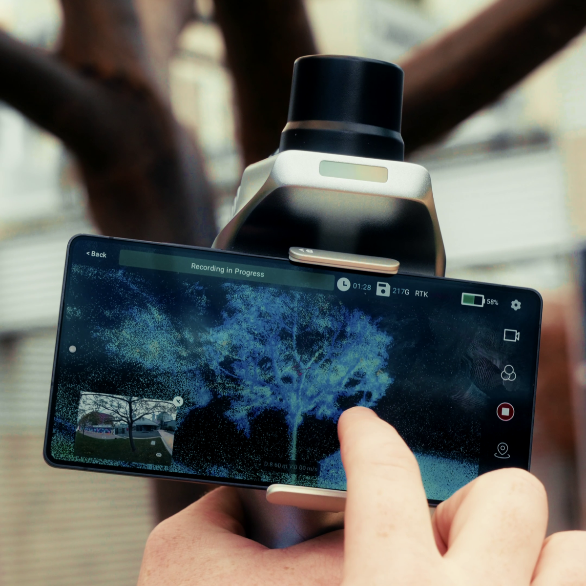
- GDA2020 MGA or site grid, your choice
- Output in the datum you ask for
- Fit to control checked and reported
- Private to your team, deleted after 1 month
Scanners and software we know
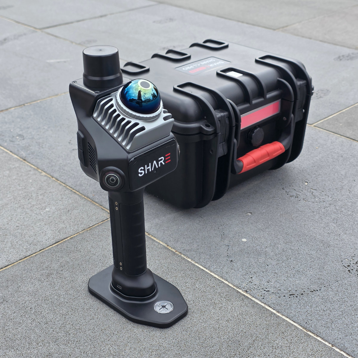
We sell and support the SHARE scanners, so we know their raw data well. No scanner yet? We can capture the site for you.
Price
What moves the price
- Size of the dataset and area covered
- How many scans or flights to merge
- Repositioning and control work
- Number of outputs
Questions
My scan drifted. Can you fix it?
Often, yes, where there's enough overlap or control to correct it. We'll look at the data and tell you before we start.
How do I send large files?
Put the data in Drive, Dropbox or OneDrive and paste the share link in the form. Include any control file in the same folder.
Will it open in CloudCompare or QGIS?
Yes. Download the LAS or LAZ from your MapShare link and open it in either. Orthomosaics and surface models come as GeoTIFF, which QGIS opens directly.
I don't have control points. Can you still help?
Yes. We can clean and deliver the cloud in its own frame, or use RTK data from the scan if it was recorded. Tell us what you need it to line up with.
Do you process data from any scanner?
We take data from SHARE, XGRIDS and other major scanner brands, and LiDAR from DJI drones or other systems. Raw projects or exported LAS, LAZ and E57 are both fine.
How long can we download the files?
For 1 month from delivery. Your MapShare link is private to your team, and after that month the data is deleted from our systems. Download everything you need to keep before then.
Tell us about the data
We'll check it and reply with a price. Quotes go out within 1 business day.