

Flagship enterprise drone
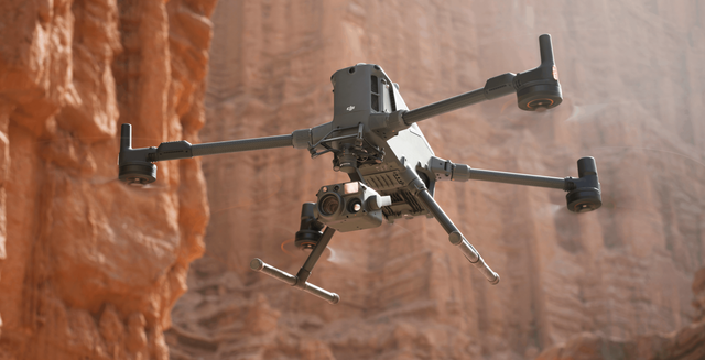
DJI Matrice 400 enterprise drone
59 minutes, 6 kg payload, rotating LiDAR for power lines. We spec the loadout and hand it over.
59 min
One flight, the whole site
Fifty-nine minutes of endurance over 6 kg of payload means a corridor or a quarry goes down in a single sortie, not three.
50 m wire detection
It sees the wire before you do
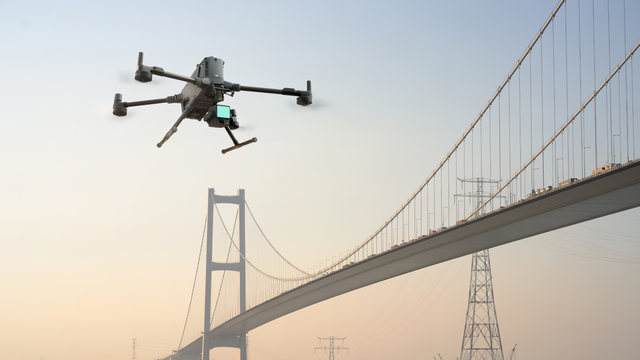
Rotating LiDAR and six-direction mmWave radar pick up a 21.6 mm conductor at 50 m, so the aircraft holds its line through infrastructure.
0.1 m hover accuracy
Comes home when the sky closes in
Vision, LiDAR and satellite positioning fuse into one solution, so a return to home under a bridge deck or beside a stockpile still lands where it should.
40 km
Forty kilometres of link
O4 Enterprise Enhanced with sub-2G carries three 1080p channels back to the controller. That is what keeps a long corridor job as one flight instead of three drives.
Compare
How it compares
Side by side on sensor, range, cameras, shutter and RTK.
| Spec |
|
|
|
|
|---|---|---|---|---|
| Sensor type | Not applicable | Full frame CMOS | Not applicable | Not applicable |
| LiDAR sensor | 1535 nm long range, Class 1 eye safe | Not applicable | Not applicable | Not applicable |
| Cameras | Dual 100 MP 4/3 CMOS RGB mapping cameras | Not applicable | Wide, zoom, thermal, laser rangefinder and NIR auxiliary light | Wide, zoom, laser rangefinder and NIR auxiliary light |
| Resolution | 12288 × 8192 per camera | 45 MP | 40 MP stills, 4K/30 video | 40 MP stills, 4K/30 video |
| Range (10% / 80% reflectivity) | 950 m at 10%, 2000 m at 80% | Not applicable | Not applicable | Not applicable |
| Zoom range | Not applicable | Not applicable | 34x optical, 400x hybrid | 34x optical, 400x hybrid |
| Thermal resolution | Not applicable | Not applicable | 1280 × 1024, 32x digital zoom | Not applicable |
| Temperature measurement range | Not applicable | Not applicable | -20 °C to 550 °C, to 1600 °C with the infrared density filter | Not applicable |
| Laser rangefinder | Not applicable | Not applicable | 3 m to 3000 m | 3 m to 3000 m |
| Shutter | Not applicable | Mechanical central leaf, plus electronic | Not applicable | Not applicable |
| Absolute accuracy | 3 cm vertical, 4 cm horizontal RMSE at 120 m | 3 cm horizontal, 5 cm vertical | Not applicable | Not applicable |
| Ground sample distance | Not applicable | 3 cm at typical mapping altitude | Not applicable | Not applicable |
| Coverage per day | Up to 100 km² per day on the M400 | Not applicable | Not applicable | Not applicable |
| Processing software | DJI Pilot 2, DJI Terra | DJI Pilot 2, DJI Terra | Not applicable | Not applicable |
| Weight | 1.60 kg, plus 145 g for the gimbal connector | 800 g with lens | 920 g | 920 g |
| Fits | Matrice 400 on the dedicated L3 gimbal connector | Matrice 400, Matrice 350 RTK, Matrice 300 RTK | Matrice 400, Matrice 350 RTK, Matrice 300 RTK | Matrice 400, Matrice 350 RTK, Matrice 300 RTK |
| IP Rating | IP54 | IP4X | IP54 | IP54 |
Complete the kit

No products match
Try adjusting your filters or search term.

Not sure which kit fits the job?
Tell us the site and the deliverable. We'll name the kit, the price and the lead time.
Open a real scan