
The handheld cloud looks internally tight. The drone roof looks internally tight. Sit them on the same kerb and they disagree by a third of a brick. Nobody mis-measured the scene. The two captures never shared a held RTK fix on the same datum.
A rover does not make a prettier point cloud. It tells the cloud, the photos and the set-out points where they are in the coordinate system you invoice. Without that, you are registering by eye and hoping the kerb forgives you.
What a live fix actually is
RTK is a difference. Rover and reference observe the same satellites. The reference knows where it is, so the difference is mostly atmosphere, orbit and clock. Apply that in real time. When the integer carrier-phase ambiguities resolve, the rover reports a fixed solution. That is the only state the rest of the kit should inherit.
A float is not a fix you process later. The ambiguities never locked. Stop, or log raw observations and post-process. Autonomous GNSS (no corrections) is metres. Code differential is still decimetres. FJD's V10i table, in open sky, puts autonomous at 1.5 m horizontal RMS and 2.5 m vertical RMS; code differential at 0.4 m / 0.8 m RMS. The centimetre-class line only appears once the integers are fixed.
The published RTK line on that same table is 8 mm + 1 ppm RMS horizontal and 15 mm + 1 ppm RMS vertical, initialisation quoted under 5 seconds, open sky. One part per million is about one millimetre per kilometre to the reference. A mount 15 km away adds about 15 mm to that term before multipath or a tree. Live pickup is not a control survey.
The reference can be a radio base you occupy, or an NTRIP stream. On most connected sites here the stream we load is AUSCORS NTRIP: Geoscience Australia's caster, nearest online mount, credentials in the controller. A shed, a cutting or a dead SIM is a radio problem, not a rover problem. Then you want a local base, a state CORS login, or PPK. The D-RTK 3 compare is the aircraft version of that fork. Ground rovers obey the same physics.
What ICSM will actually accept
ICSM's Guideline for Control Surveys by GNSS (SP1 v2.2, 7 December 2020) is the national method document. Quality is expressed as uncertainty at 95 percent confidence, not a brochure RMS. Datum-class control still wants simultaneous static observations, redundancy and a least-squares adjustment. RTK is how you pick up topography, set out a point and check a mark. It is not how you extend the national network. "The rover said fixed" is not a cadastral certificate.
GDA2020 is the datum. GNSS natively speaks an ellipsoid. Australian Height Datum is a gravity surface. AUSGeoid2020 is the grid between them. Occupy a mark in AHD, type the ellipsoid height into the base, and the model sits out by the N-value: tens of metres, not millimetres. Name the system once, on the rover and in the processing package.
Where a rover fails
No held fix. Canopy, a glass facade, a cutting, a plant room. Cățeanu and Moroianu (2024) left a Stonex S10 under pine and beech-oak in Romania: no fixed solutions across 2,670 epochs, 97 percent differential-only, 2.03 m horizontal RMSE. If the site is a stand or a warehouse, the rover is a tie at the door, not a trajectory through the trees.
Multipath. Reflected signals from steel, water, vehicles. The rover can look fixed and sit off the kerb you trust. Independent check shots are how you find it.
Tilt without a fix, or tilt past the rated angle. IMU compensation assumes the antenna already has a position worth rotating. FJD's V10 tilt term is 8 mm + 0.6 mm per degree RMS, 0 to 60 degrees, on top of the RTK line, in the conditions of that spec. At 30 degrees the tilt term alone is about 26 mm RMS. None of those numbers survive a float.
A laser or a camera on a float. V4e Pro's green laser is quoted inside 3 cm at 3 m when tilt stays within 30 degrees. V10L quotes laser error within 2 cm at 5 m, Class 2M green. Those are offset methods. They inherit whatever the rover believed about itself when you took the shot.
Ground control stays useful. RTK expands the days you finish without a field of targets. Legal boundaries, long traverses and anything you have to defend still want independent marks.
Three ways to reach the mark
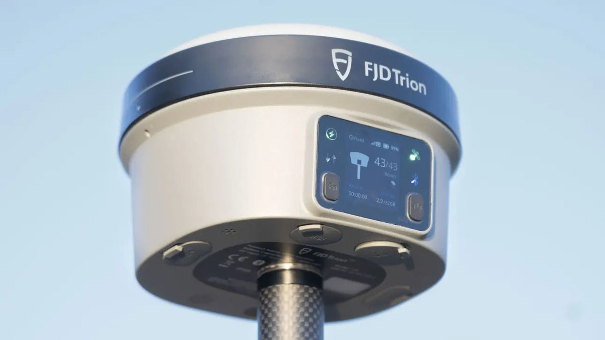
FJD Trion's V-series is three ways to occupy, or not occupy, a point. All three run the same centimetre-class RTK line in open sky. The split is how you reach the mark.
V10 is the survey pole. Dual cameras and AR stakeout on V10i; a visible green laser on V10L for night work, water and facades; compact AR on V10a when the crew wants the overlay without the full visual-measure kit. IP68. Kits ship as receiver plus controller. The controller path is a quote item.
V4 is the 320 g pocket rover you point. No 5/8 pole. Mini for occupied shots. Pro when the green laser is how you reach a mark you cannot stand on.
V1 is occupied RTK with a radio. V1t is the IMU-tilt rover that also works as a base. V1 Base is the 400 MHz station the rover listens to when NTRIP is the wrong path.
Field software is Trion Survey. We set the coordinate system and the NTRIP or radio profile before the first paid day. Export is confirmed against the package you already invoice.
LiDAR, said plainly
We already sell handheld scanners, and we have a direct factory relationship with SHARE3DCAM. Walking capture, the processing path and MapShare Studio for twelve months with those scanners is the stack most crews here already run. We are not going to tell a customer to throw that away because another OEM also makes a scanner.
Walking a site, interiors, plant, under canopy, as-built that has to land in the browser scene the client already opens: that handheld is the default. The kit that leaves here is configured for AUSCORS NTRIP and handed over by the people who will answer the phone.
A drone-mounted scanner the client can only receive as FJD Trion S2 (their Trion Scan / Model path, their mount): we will quote the S2 with the FJD drone mount. Sixteen-channel LiDAR, FJD quotes 120 m at 80 percent reflectivity on the standard unit, relative accuracy within 1 cm and absolute 3 cm on that sheet. The mount is FJD's pod. We confirm airframe, mass and power on the quote. We do not assume a model. Other FJD handhelds stay off the store.
What we have not tested
We have not run an SP1-style control survey on a V-series rover against a known pillar network and published the residuals. The millimetre lines above are FJD's open-sky RMS figures, not our pillar test. We have not timed the "under 5 seconds" initialisation on a cluttered suburban street. We have not flown S2 on every airframe that looks like it might take the pod.
Checks before you sign the sheet
- Fix, not float, on the shots you will defend.
- Mount or base within a baseline you can live with. Stations drop out; recheck the AUSCORS map.
- Coordinate system named: GDA2020 / MGA zone, ellipsoid or AHD.
- Independent check on a known mark at the start and the end of the day.
- Offsets (laser, visual, tilt) only after the rover itself is fixed, and inside the distance and angle the spec quotes.
Send the coordinate system you invoice in (MGA zone, AHD or ellipsoid) and whether the marks you cannot occupy are laser, visual or pole. We will say which rover, or whether the missing piece is a rover at all.
FAQ
V10, V4 or V1?
V10 when the crew already works on a 5/8 pole and needs visual measure, a green laser or compact AR. V4e when you want a 320 g receiver you point; Mini if you occupy the mark, Pro if the laser does the reach. V1 when you want an IMU-tilt rover and a 400 MHz base for occupied RTK.
Does tilt mean I can skip levelling the pole?
No. Tilt compensation rotates a position you already have. V10 quotes 8 mm + 0.6 mm per degree RMS to 60 degrees. At 30 degrees that tilt term is about 26 mm RMS, in the OEM's conditions, on top of the RTK line. Past the rated angle, or on a float, you are guessing.
NTRIP or a radio base?
AUSCORS NTRIP on a connected site with a nearby mount. A V1 base when the mount is far, the SIM is dead, or the client has given you a mark in MGA2020 / AHD. PPK is the backup on both.
Why still the handheld scanners if FJD also makes LiDAR?
Because the walking workflow, the factory relationship and the software path we already run are the default. FJD LiDAR in this appointment is the S2 drone-mount kit, quoted when that is the only scanner the brief will accept.