
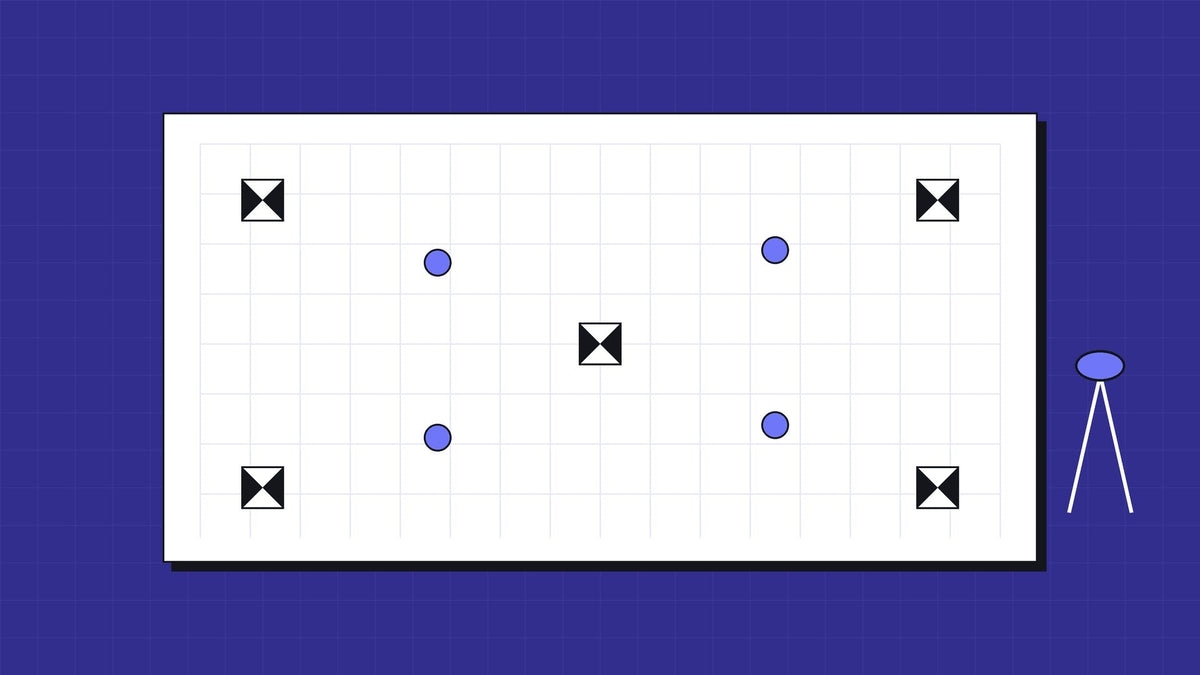
Often you can drop most ground control, but not your check points. RTK puts every photo close to the right place, so a drone survey can hold a few centimetres without a field full of targets. What RTK cannot do is prove it. A handful of independent check points is what turns "the drone said so" into a result a surveyor or client will sign.
What RTK does, and what it doesn't
RTK compares the aircraft's satellite readings with a reference station and corrects them as it flies. On a DJI Matrice 4E, DJI quotes 1 cm plus 1 ppm horizontal and 1.5 cm plus 1 ppm vertical with an RTK fix. That is the position of the aircraft's antenna, not the accuracy of your map. The map also carries the camera calibration, the processing and the site itself.
DJI's own test of the 4E shows why RTK matters: about 5.5 cm 3D error without ground control, and about 5.3 cm with it, against independent check points on the same flight (DJI's comparison). On a good day, full control added very little. The catch is "on a good day". A lost fix, a wrong base coordinate or a datum mix-up can shift the whole job, and nothing on screen will tell you.
Ground control points and check points are not the same thing
- Ground control points (GCPs) go into the processing. The software bends the model to fit them.
- Check points stay out of the processing. You compare the finished model against them to measure the error.
With RTK, you can often cut GCPs to a few, or none. You should not cut check points. They are the only independent evidence the result is right, and survey guidance agrees: South Australia's Surveyor-General guideline for cadastral GNSS warns that on-screen precision "may be erroneous and misleading" and asks for independent checks.
Where the corrections come from
| Source | How it works | Watch out for |
|---|---|---|
| Network RTK | Corrections streamed over the internet from reference stations | Needs mobile data on site; distance to the station matters |
| AUSCORS | Geoscience Australia streams raw observations from its reference stations after you register; ARGN and SPRGN streams are free | Not a network solution, best effort latency; choose the nearest live station |
| Your own base | A base such as the DJI D-RTK 3 on site, sending corrections over its own data link | The base must sit on a known coordinate, or the whole job shifts with it |
| PPK | Raw data logged in the field and corrected afterwards | No live fix to confirm in the air; processing step after the flight |
The D-RTK 3 works as a base, a relay or a rover, which is handy on remote sites with no mobile coverage. Uncalibrated, DJI rates its own position at 1.5 m horizontal and 3 m vertical, so set it on a known mark or calibrate it first.
How many points to set
For a typical drone mapping job:
- Control: DJI Terra needs at least three GCPs and recommends four or more when you use them. Spread them around the edge, with one near the middle.
- Checks: points that are not used as control, spread across the site and at different heights. We set at least five on a small site.
- Formal reporting: if a client wants accuracy stated to a published standard, follow it. ASPRS Edition 2, for example, asks for at least 30 check points for a formal accuracy statement.
A rover such as an Emlid Reach on the same corrections is the quick way to measure them.
Where full control still earns its place
- Legal boundaries and anything cadastral
- Sites with no reliable corrections, or a base on an unknown point
- Long corridors, where small errors add up
- Deliverables that tie into an existing site datum, including AHD heights, where the step from GDA2020 through AUSGeoid2020 is a common source of vertical shift
- Interiors and mixed sites, where a handheld scanner such as the SHARE C1 Pro has to land on the same coordinates as the drone (our one site model post covers that)
If you are choosing between a camera and LiDAR for the job, see our LiDAR drone guide.
FAQ
Do I need ground control points if my drone has RTK?
Often you can use few or none for control, but you should still set independent check points to prove the accuracy.
What is the difference between a GCP and a check point?
A GCP is used in processing to fit the model. A check point is kept out of processing and used to measure the error afterwards.
Is AUSCORS free?
Streams from Geoscience Australia's ARGN and SPRGN stations are free once you register. They are raw observations, not corrections, delivered on a best effort basis.
How many GCPs do I need for a drone survey?
DJI Terra needs at least three and recommends four or more, spread around the site, plus separate check points.
Do I need a base station or is network RTK enough?
Network RTK is enough where you have mobile data and a nearby station. Remote sites without coverage need your own base on a known point, or PPK.