
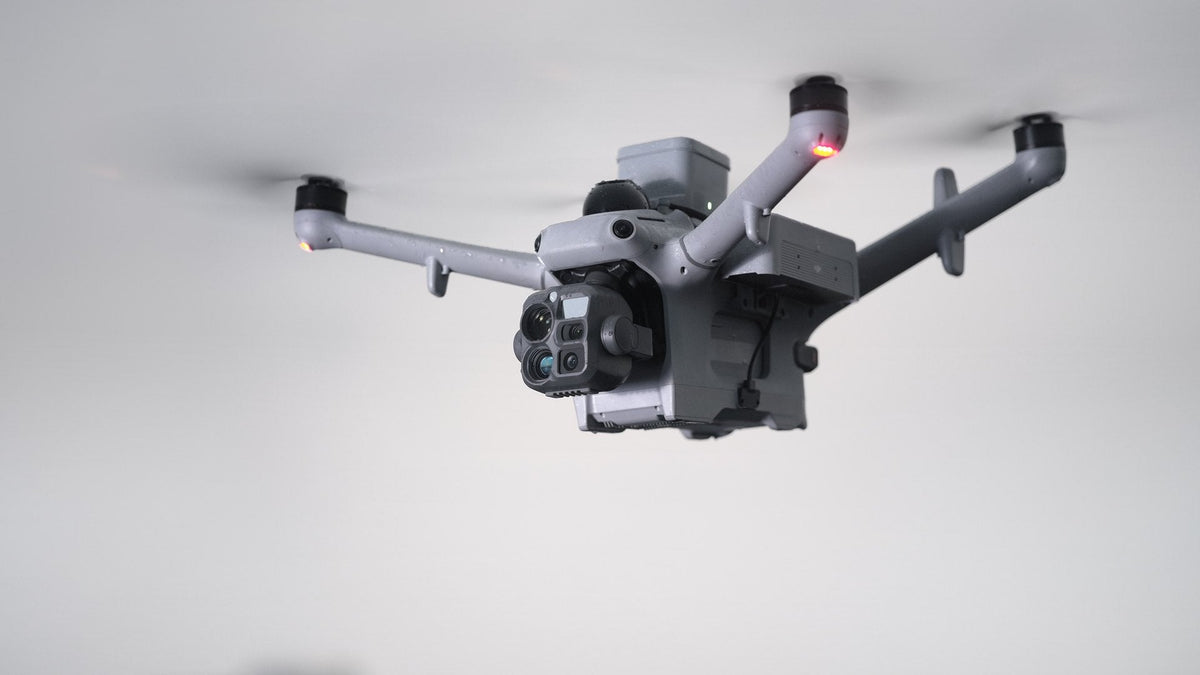
For years, buying a DJI enterprise aircraft meant choosing a side. The mapping model had a mechanical shutter. The thermal model had the thermal camera and the zoom. Mavic 3E or Mavic 3T. Matrice 4E or Matrice 4T. On the docks it was the same: Matrice 3D or 3TD on Dock 2, Matrice 4D or 4TD on Dock 3.
That split is going away. Three things in the last four months point the same way, and DJI's launch later today may carry it to its next aircraft.
Dock 4 shipped with one aircraft
When DJI launched Dock 4 on 13 October, it launched one aircraft with it, the Matrice 5TD. There is no mapping twin. DJI's own briefing put it plainly: on Dock 3 the 4D maps and the 4TD patrols, and on Dock 4 the two merge.
The 5TD maps with an electronic rolling shutter, the kind the thermal models have always had. A rolling shutter reads the sensor line by line while the aircraft moves, which skews the image and is the reason mapping models carried a mechanical shutter. DJI's answer is to stamp every line with its own position, orientation and speed at the instant it is exposed, then correct each line to where it really was. A chip 16 times more powerful merges each 50 MP frame down to 12 MP. DJI quotes aerial-triangulation check-point accuracy of around 10 cm, flown at 120 m, nadir or oblique, without terrain following.
DJI Terra now reconstructs rolling-shutter data
The second piece is software. At the end of July DJI updated DJI Terra with high-precision rolling-shutter reconstruction for aerial triangulation, 2D maps and 3D models. DJI says it does this "without requiring a global shutter camera." An Optimize RS Files switch is on by default, rolling-shutter and mechanical-shutter images can be mixed in one project, and existing rolling-shutter data can be reprocessed.
DJI's test numbers are honest about the limit. Flying a Matrice 4T with RTK on area routes at 60 m and 120 m, it measured horizontal accuracy of about 3 to 4 times the GSD and vertical accuracy of 4 to 5 times the GSD. That is good enough for progress maps, stockpile checks, incident scenes and asset records. DJI still recommends a mechanical-shutter model such as the Matrice 4E where the job is held to survey-grade tolerances.
What DJI launches today
DJI Enterprise launches a new product at 11 pm AEDT tonight, 5 November. DJI has not named it. Early reports read the teaser as a folding-arm thermal aircraft carrying the same six-window gimbal as the Matrice 5TD. The question we are watching is simple: does a separate mapping model launch alongside it, or does the thermal aircraft take on the mapping job itself, as the 5TD does on Dock 4? We will add DJI's specs here once they are published.
What it means if you buy one aircraft
For most operators the merge is good news. One aircraft that maps the site in the morning and flies a thermal inspection at night means one fleet, one set of batteries and one training plan. Mapping becomes something the inspection or response aircraft also does, rather than a reason to buy a second one.
It does not retire the mechanical shutter. If your deliverable is checked against survey control, we would still put it on a mechanical-shutter camera or LiDAR, such as the Matrice 4E or the Matrice 4D, with ground control in the plan. The merged aircraft fits the jobs where a map is one of several outputs, not the only one.
If you are deciding between one aircraft and two for next year, talk to us. We will match the camera to the tolerance your deliverable has to meet.